Lower Bells Canyon Reservoir
A family-friendly climb to a glassy reservoir with the Wasatch peaks mirrored on its surface. A gentle loop circles the shoreline — one of the valley's favorite sunrise spots.
Lower Reservoir details →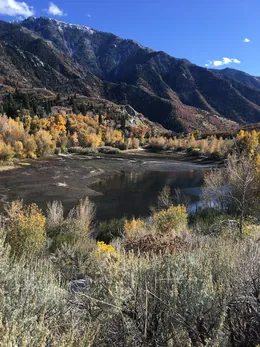 The first reservoir
Two alpine reservoirs, two roaring waterfalls, and 4,100 feet of granite-walled canyon between them. Everything you need to hike one of the Wasatch Front's most beautiful — and most demanding — trails.
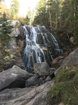 The first waterfall
Bells Canyon works like a ladder — each rung is a worthy destination on its own, and each one roughly doubles the effort of the last.
A family-friendly climb to a glassy reservoir with the Wasatch peaks mirrored on its surface. A gentle loop circles the shoreline — one of the valley's favorite sunrise spots.
Lower Reservoir details →The classic Bells Canyon hike. A steep, rocky climb alongside Bells Canyon Creek ends at a powerful cascade pouring over granite slabs — thunderous during spring runoff.
Lower Falls details →Only about 0.6 miles past the first falls, but noticeably steeper and quieter. A taller, wilder cascade with far fewer visitors and big views back over the Salt Lake Valley.
Upper Falls details →A true alpine objective at 9,370 ft, tucked beneath Lone Peak's granite cirque. Faint trail, boulder fields, and relentless grade — one of the toughest maintained-trail day hikes on the Wasatch Front.
Upper Reservoir details →Stay back from the waterfalls. The granite slabs around both falls are polished and deceptively slick, and people have been seriously injured and killed here. During spring runoff (May–June) the creek is fast, deep, and ice-cold — keep children close and never climb beside the falls.
No dogs, no swimming — it's the law. Bells Canyon is a protected culinary watershed for the Salt Lake Valley. Dogs and any water contact (swimming, wading) are prohibited and actively ticketed.
Parking fills before sunrise on weekends. The Granite and Boulders lots are tiny and go first — the 133-stall Preservation Trailhead lot is your best bet. Street parking on Wasatch Boulevard and in the neighboring subdivisions is prohibited and enforced with towing. See the parking guide for strategies.
It's steeper than the mileage suggests. Beyond the lower reservoir the trail averages well over 1,000 ft of gain per mile in places, on rocky, uneven tread. Budget more time than you would for a typical trail of the same length, and carry more water than you think you need.
| Destination | Round trip | Elevation gain | Difficulty | Best season |
|---|---|---|---|---|
| Lower Reservoir | 1.5 mi | ≈390 ft | Easy | Year-round |
| Lower (First) Falls | 4.6 mi | ≈1,520 ft | Moderate–Hard | May–October |
| Upper (Second) Falls | 5.9 mi | ≈2,460 ft | Hard | May–October |
| Upper Reservoir | 9.2 mi | ≈4,160 ft | Very Hard | July–early October |
Distances vary slightly by trailhead. Figures are approximate and compiled from published trail guides — see sources.